
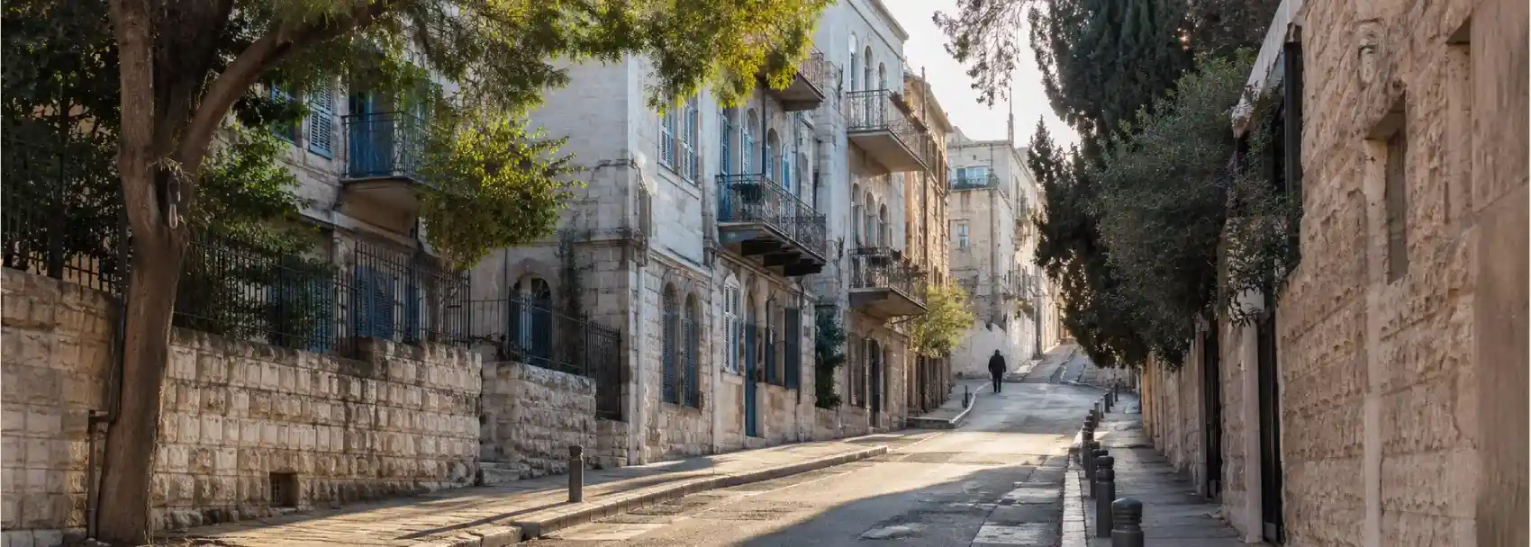
A guide to Strauss Street and modern Jerusalem begins with an uphill walk. The street runs north from the busy meeting point of Jaffa Road and King George Street toward the area around Mea Shearim, and its changing character becomes visible before any single landmark explains it. Shops, apartment buildings, religious institutions, older façades, traffic, and pedestrians share the same slope. Strauss Street is not a polished historical promenade. It is a working urban route, and that is exactly why it offers such a useful introduction to the city beyond the Old City walls.
Jerusalem can be easy to imagine as a city of gates, domes, walls, and excavations. Those places matter, but modern Jerusalem is also made from ordinary crossings and repeated routines. A street can carry the memory of philanthropy, the architecture of the British Mandate period, the visual language of ultra-Orthodox neighborhoods, and the practical pressures of present-day traffic. Walking Strauss Street asks you to hold these layers together without forcing them into one simple story.
Read the street before you read the landmarks
Start near the junction with Jaffa Road, where the city feels broad, commercial, and connected to major east-west movement. Before climbing, look along the pavement and up at the building line. Street-level businesses announce the present, while balconies, roof shapes, stone walls, and older corner buildings reveal earlier phases of development. The transition is not sudden. It unfolds block by block, which makes the walk more revealing than a list of isolated addresses.
Strauss Street takes its name from Nathan Straus, the American Jewish philanthropist whose work in early twentieth-century Palestine included projects intended to support public health and welfare. The name is a reminder that modern Jerusalem was shaped not only by rulers and armies, but also by institutions, charitable networks, urban improvements, and people whose influence travelled across the Mediterranean. A street name is not a complete biography, yet it can open a question about who invested in the city and what kind of city they hoped to build.
At the lower end, the route feels tied to central Jerusalem’s mixed commercial energy. Farther uphill, the pace and visual language change. Signs, clothing, storefronts, and patterns of movement may signal a more concentrated religious neighborhood. Do not treat that change as a boundary between two sealed worlds. People cross it constantly, and the street itself connects them. Modern Jerusalem is often most visible at these points of overlap, where different expectations about time, dress, noise, and public space occupy one road.
Notice the layers in the buildings
One of the pleasures of the walk is learning to look at buildings as evidence of changing urban ambition. Early twentieth-century construction often combines local limestone with details that reflect imported architectural ideas, including tiled roofs, corner treatments, balconies, and large openings designed for light and air. Later additions may rise above or attach themselves to older structures. Repairs, signs, shutters, air-conditioning units, and security features show how a building continues to absorb new demands.
The Evangelical Alliance Church is one of the notable historic buildings associated with the street. Historical accounts place its construction between 1907 and 1913, and its restrained exterior is a useful counterpoint to the idea that every religious building must announce itself through elaborate decoration. Whether you enter or simply observe from the public street, allow the building to sit within the wider neighborhood. Its presence is part of a city in which religious communities, institutions, and urban functions have long been placed close together.
Look also at the less famous structures. A building with no plaque can still show how apartments were arranged, how a shop was adapted, or how a street edge changed over time. The modern city is stored in these ordinary details. A recessed entrance, a narrow stairway, or a shaded balcony can tell you about climate, privacy, commerce, and family life more honestly than a grand monument that has already been separated from its original routine.
As you move north, listen to the soundscape. Buses and delivery vehicles may compete with conversations, school traffic, prayer, and the sounds of small businesses. The noise is not an interruption to the history. It is evidence that the neighborhood is still functioning. A heritage route should not make daily life disappear. The point is to understand how the city’s past remains present inside the pressures of the current day.
Build the walk around transitions
Plan Strauss Street as a one-way uphill route rather than a hurried out-and-back. Begin at Jaffa Road and King George Street, take time with the lower buildings, and continue north while noting the gradual shift in street life. If you have energy, continue toward the streets around Mea Shearim, but decide in advance how far you want to go. The strongest part of the visit is not reaching a particular endpoint. It is recognizing the moments when the city’s atmosphere changes without a clear gate or sign.
Pair the walk with a short detour that gives context. You might connect it to the older urban fabric around the Old City, or use it as a counterpoint to the guide to Jerusalem’s four historic quarters. The comparison is useful. Inside the walls, historic identity often announces itself through sacred sites and dense lanes. On Strauss Street, it appears through street names, building types, institutions, and the negotiation between neighborhoods that continue to evolve.
Give yourself at least two deliberate pauses. The first can be near the lower junction, where central Jerusalem’s traffic and commercial movement are easiest to observe. The second can be farther uphill, where the character of the street has shifted. At each pause, ask what has changed and what has remained. The answer may involve signage, building height, pedestrian behavior, or the way a shop meets the pavement. Small comparisons make the walk memorable.
Do not rush into side streets simply because they look atmospheric. Some lead into residential areas where visitors are less expected, and others may carry specific religious or community norms. Stay on public routes, read signs, and turn back if the street no longer feels like a route for casual walking. The most respectful urban exploration knows when observation is enough.
Before you go
Strauss Street is a living urban route, not a controlled museum circuit. Check current transport information, allow for traffic, and expect the walking pace to be slower than the map suggests. The slope is manageable for many travelers, but the combination of uneven pavement, crossings, vehicles, and long standing can be tiring. Wear shoes with a secure sole and carry water in warm weather.
Dress with the destination in mind if you plan to continue into religious neighborhoods or visit an institution. Clothing that covers the shoulders and knees is a flexible choice, and a light layer can help you adapt without interrupting the route. Follow local signs and behave discreetly around homes, schools, places of worship, and anyone who appears not to be part of the visitor experience.
Photography should begin with attention, not with the camera. Ask before photographing people, shop interiors, or religious activity. Do not stop in the middle of a narrow pavement to frame a façade, and keep entrances clear. Strauss Street rewards travelers who can notice architecture while allowing the street to continue moving around them.
The street is valuable because it complicates the idea of modern Jerusalem. It is not separate from heritage, and it is not simply a background for old buildings. It is a place where names, institutions, architecture, faith, commerce, and daily movement keep rewriting the city. Walk uphill slowly and Strauss Street becomes a practical lesson in how Jerusalem carries its history into the present.
References & Visitor Notes
The street’s historic buildings and neighborhood context are informed by the historical walk through Straus Street published by The Times of Israel, the Jerusalem Municipality overview of Mea Shearim, and the National Library of Israel feature on Jerusalem’s early tourist map. Recheck local conditions and access before visiting.