
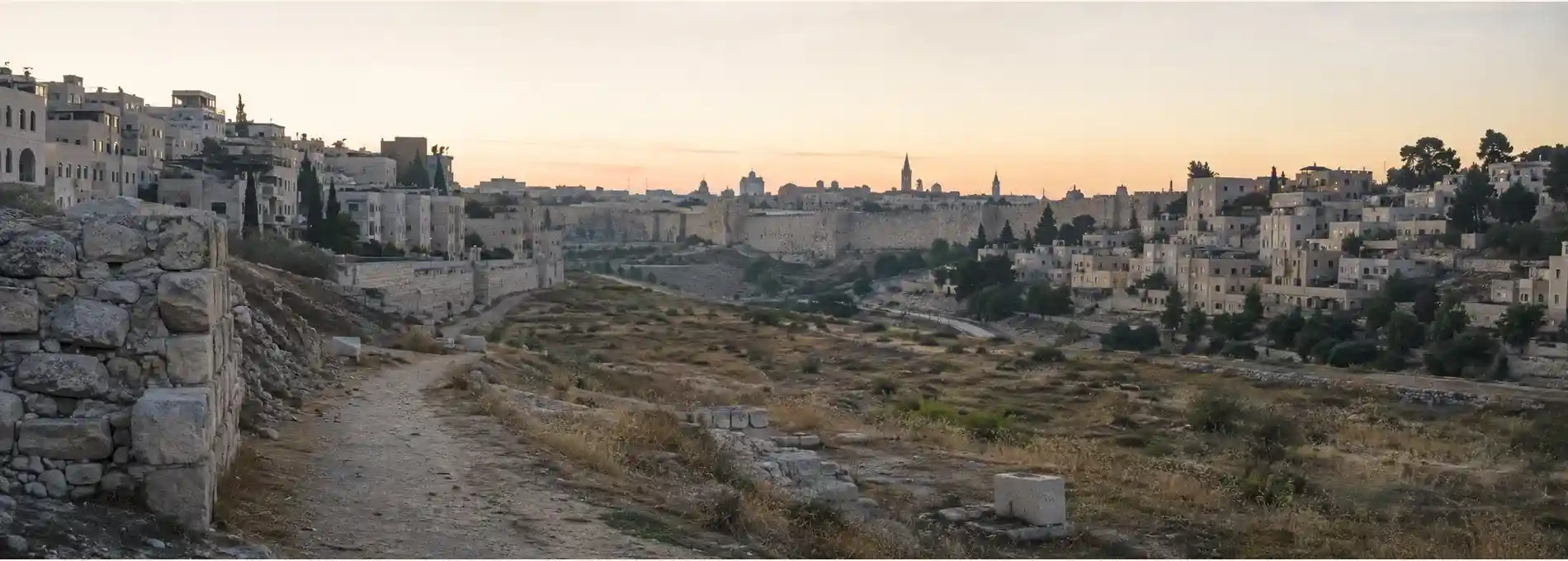
Jerusalem’s former No Man’s Land is difficult to see precisely because the city has grown around it. Roads, offices, apartment buildings, museums, and busy pedestrian routes now occupy spaces that once sat between Israeli and Jordanian positions. The absence of a visible fence can make the history feel abstract, but the urban landscape still holds clues. A damaged façade, an awkward open space, a former military position, or a line that seems to ignore the logic of the street can turn an ordinary walk into an encounter with the city’s divided past.
This is a subject that requires care. The 1948 war, the 1949 armistice arrangements, the division of Jerusalem, and the changes that followed in 1967 remain connected to political and legal disputes that have not disappeared. This guide focuses on the physical history of the city and on how to read its traces. It does not present a final answer to Jerusalem’s status or replace the perspectives of people who experienced displacement, separation, conflict, and political change.
Understand the line before looking for the landscape
After the fighting of 1948, Jerusalem was divided between Israeli-controlled West Jerusalem and Jordanian-controlled East Jerusalem, including the Old City. The ceasefire arrangements created a line between the positions, and the space between sections of that line became known as No Man’s Land. The United Nations text of the 1949 Israel-Jordan General Armistice Agreement is an important primary reference for understanding the status of armistice arrangements. The line was a military demarcation rather than a simple urban boundary drawn to follow existing streets.
That distinction matters when you walk the area today. A permanent border usually suggests gates, customs, clear jurisdictions, and an organized edge. A ceasefire line can be rougher and more improvised. In Jerusalem, buildings, roads, empty lots, walls, and military positions were pulled into a landscape of uncertainty. The line could be marked on a map yet remain difficult to translate into a comfortable route on the ground. That mismatch is one reason the history feels so strongly in the city’s spaces.
The term No Man’s Land also needs a human reading. It was not an empty stage waiting for a later city. People lived on both sides, worked around danger, adapted to restrictions, and carried memories of places that had become difficult or impossible to reach. Families, religious communities, and institutions were separated by the political reality of the line. A thoughtful walk should therefore avoid treating the area as an atmospheric ruin detached from the lives that shaped it.
Read the traces that survived the boundary
One useful starting point is the area around the former Allenby Square, now associated with the Israel Defense Forces Square, near the route between central Jerusalem and the Old City. Historical accounts describe the square and nearby buildings as places where earlier Ottoman, British, wartime, and postwar layers met. The rounded historic building associated with the former city hall is especially useful for reading the relationship between civic architecture and conflict. Marks on stone can be evidence, but they should be interpreted alongside the broader history of the neighborhood.
The French Hospital of St. Louis offers another layer. The hospital was established outside the Old City in the nineteenth century, and its location places medical, religious, and urban history close to the later line. A building can survive a conflict while its surroundings change meaning. When you encounter a former hospital, church, civic structure, or private house in this area, ask what it was built to do before the boundary appeared and how its role changed when the city became a frontier.
Beit Turjeman is another important point in the story of the seam. Accounts of the building connect it to the early twentieth-century city, the 1948 fighting, the years when it served as an Israeli position, and later cultural use. Its history demonstrates why no single label is enough. A house can be an architectural object, a military position, a museum site, and a contemporary cultural space across different periods. The building’s meaning changes because the city around it changes.
Do not search for one dramatic scar and ignore the rest of the route. The line is also visible in interruptions. A street may widen without an obvious reason, a building line may stop, or a new road may pass through land that once carried wire, barriers, and observation positions. The city’s redevelopment can conceal the boundary while also preserving its consequences. Absence becomes part of the evidence.
Walk the seam as a sequence of questions
A practical route can begin near Jaffa Road and the central streets leading toward the Old City, then continue past the civic and institutional buildings associated with the former boundary. The aim is not to recreate a military line with false precision. It is to move through a series of places where the city’s older edge, wartime division, and present-day circulation can be compared. Use the broad view first, then look at façades, side streets, and the relationship between buildings and roads.
At the first stop, ask what kind of city the building or square was designed to serve. At the second, ask what changed when access became dangerous or restricted. At the third, ask what has been restored, repurposed, or allowed to disappear. These questions make the route more honest than a simple before-and-after story. The goal is not to claim that the city has healed every division. It is to notice how the physical environment carries history even when political language remains contested.
Pair the walk with the guide to Strauss Street and modern Jerusalem. The two routes offer different ways of reading the same broader city. Strauss Street shows how modern neighborhoods grow through movement, institutions, and daily routines. The former No Man’s Land shows what happens when movement is interrupted by a military boundary. Together they make a stronger argument for walking beyond the Old City when you want to understand Jerusalem as a living urban system.
Keep the pace measured. This is not a route that needs theatrical narration at every corner. Some details may be visually obvious, while others require a map, a photograph, or a local historical account. Leave room for uncertainty. If two sources describe a place differently, record the difference rather than flattening it. Urban memory is often made from competing accounts, and a responsible travel guide should make that complexity visible.
Before you go
Use current maps and local guidance, but remember that map lines do not automatically explain political status or historical experience. Check which buildings are open to visitors and which can only be viewed from public streets. Do not enter abandoned structures, cross barriers, or approach military or security installations for the sake of a photograph. A boundary remembered through a safe public route is more valuable than a risky attempt to reach a restricted trace.
Plan for ordinary city conditions. Traffic, construction, heat, uneven pavement, and busy crossings can make the route tiring. Wear comfortable shoes and carry water. If you are walking with children or anyone who finds long urban routes difficult, choose a shorter section and spend more time at one or two accessible viewpoints. The story does not become less important because the walk is shorter.
Photography needs special restraint around former military sites, government buildings, security personnel, and local residents. Follow posted instructions and avoid photographing people without permission. Do not turn damage, memorials, or private grief into a backdrop for a casual performance. The most useful images often show the relationship between a building and its surroundings rather than isolating a scar as an object.
Jerusalem’s former No Man’s Land is a lesson in how quickly an urban landscape can become a political instrument and how slowly its traces disappear. Walking the route cannot resolve the city’s history, but it can make the history harder to ignore. Move carefully, name the uncertainty, and let the streets show how a former boundary continues to shape the city long after the physical barrier has gone.
References & Visitor Notes
The armistice framework is grounded in the United Nations text of the Israel-Jordan General Armistice Agreement. The historical route and surviving urban traces are informed by The Times of Israel’s account of Jerusalem’s former No Man’s Land, the Jerusalem Story explanation of the 1949 Green Line, and the Jerusalem Post historical walk along the former Israel-Jordan border. Political and access conditions should be checked again before visiting.