
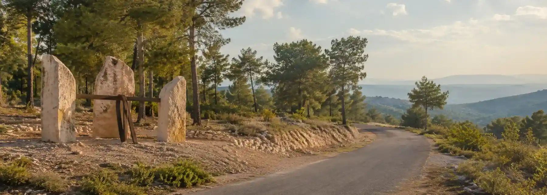
Sculpture Road and the forest as an open-air gallery is best understood as a journey between works of art rather than a single attraction. In official KKL-JNF material, the route is called the Sculpture Trail and runs through Tzora Forest, also known as the President’s Forest. The road carries you between stone forms, recreation areas, lookouts, woodland, and traces of local history. You can drive much of it, stop for short walks, or give the route an entire morning by moving slowly from one sculpture to the next.
The experience begins with a useful question: what happens when art is placed beside a living landscape instead of inside a gallery? At Tzora, the answer changes with the light, the season, and your distance from each work. A sculpture that seems monumental from the road can disappear into the trees when you walk closer. Another may frame a view toward the hills or echo the shape of a nearby rock. The forest does not function as a neutral background. It edits the work, shelters it, and sometimes competes with it.
Road or trail? Use both names as a guide
Many travelers call the route Sculpture Road because it is accessible by private vehicle and because the artworks appear along a long forest road. KKL-JNF uses the name Sculpture Trail, and its route description places the trail through Tzora Forest over roughly nine kilometers. A separate KKL-JNF overview describes the route as around ten kilometers. The difference reflects how the route is measured and presented, not a reason to chase an exact number. For planning, think of it as a linear forest route with multiple stopping points, not as a short loop that can be finished without pauses.
The forest is also known as the President’s Forest because part of it is dedicated to Chaim Weizmann, the first president of Israel. That name adds historical context, but the visit does not require a formal lecture at every stop. It is enough to notice that the landscape carries several layers at once. The planted forest is a modern project, the sculptures are a later cultural intervention, and the ridges and archaeological remains belong to a much longer human geography.
Learn to look before you start collecting photographs
Give the first sculpture more time than you think it deserves. Stand at the roadside, then approach from a different angle. Look for the point at which the work stops being an object and starts becoming part of the slope. Environmental art often depends on this shift. The forest changes the scale, hides edges, and creates a moving frame as branches, shadows, and open sky pass behind the stone.
KKL-JNF’s description notes that artists were given large pieces of stone and tools with which to create works placed along the route. The result is a collection shaped by the local scenery and by memories of the past. Some sculptures blend into the environment, while others refer directly to history or biblical figures. Samson appears in the route’s visual language, and another arrangement of rocks suggests Delilah’s comb. Those references are invitations to consider how stories are carried by landscape, not instructions to reduce every work to an illustration.
Notice the spaces between the sculptures. Recreation areas, roadside clearings, and lookouts give the route its rhythm. The pauses are not empty intervals between important stops. They are where the forest becomes visible as forest. In winter and spring, flowers change the color of the ground. In warmer months, shade and the sound of wind through the trees may matter more than any individual artwork. The route works because it allows art and landscape to alternate without one completely replacing the other.
Build the route around a few strong pauses
Approaching from Highway 44, the route leads toward a sequence of lookouts and recreation areas. The Split in the Rock lookout is one early point where the road opens into a place to stop and look outward. Farther along, the olive-tree area shows how small stone dams can manage runoff, reduce erosion, and create seats beneath the trees. It is a particularly good example of the route’s central idea: practical landscape features and designed cultural features can occupy the same view.
Mitzpe Tzora provides another strong pause. KKL-JNF describes its large wooden platform as shaped like the bow of a ship, while the stone structure beneath it is associated with the remains of the Arab village of Sar’a. The site therefore connects a contemporary lookout with older settlement history and with the wartime use of the area. You do not need to make every stop a solemn historical lesson. Simply allow the view and the remains to remain in the same frame.
If you want more walking, the route offers connections toward Tel Tzora and the Samson Trail. KKL-JNF describes the Samson Trail as about 1.5 kilometers and the Samson Ridge Trail as about 1.5 kilometers to the ridge tip. These branches change the character of the visit from a drive with stops into a more deliberate hike. They also make it important to separate the time needed for the main road from the time needed for a side trail. A short distance on a map can still involve heat, slope, uneven ground, and a slower pace around viewpoints.
One good strategy is to choose three kinds of stop: one place for art, one place for a wide view, and one place where the woodland itself becomes the subject. This keeps the outing from becoming a checklist. It also makes the route work for companions who are interested in different things. One person can study the sculpture while another finds a shaded bench, and everyone can regroup at the next lookout.
Before you go
Check the current KKL-JNF directions before driving. The official route description lists access from Highway 44, the road toward Kibbutz Tzora and Deir Rafat convent on Route 3835, and a connection from Moshav Tarum near Mitzpe Tzora. It also notes that access from Highway 44 is restricted on Shabbat and Jewish holidays, and that a section between Tel Tzora and Route 3835 is closed to buses. Road conditions and access arrangements can change, so use the current official information rather than an old map or a remembered itinerary.
The entire length of the Sculpture Trail is open to private vehicles according to KKL-JNF, but that does not mean every stop is equally easy to reach on foot. Wear shoes that can handle dirt tracks and short slopes. Carry water, especially if you plan to leave the car for a ridge walk. In hot weather, begin early and treat shade as part of the itinerary. If you visit after rain, expect mud and changing conditions on unpaved sections.
Keep a respectful distance from sculptures and do not climb on them unless a site specifically allows it. Avoid moving stones, picking flowers, or leaving food near the artwork and recreation areas. The route is shared by drivers, walkers, families, and people using the forest as a local place to rest. Slow down near bends, pull completely off the road at designated areas, and let the landscape remain generous for the people who come after you.
Sculpture Road is memorable because it asks for two kinds of attention at the same time. You look closely at a form made by an artist, then look farther away toward the ridge, the trees, and the valley. The forest prevents the art from becoming isolated, while the art gives the forest a new set of questions. Take the route slowly and the open-air gallery keeps changing long after the first sculpture is behind you.
References & Visitor Notes
Route length, access points, vehicle guidance, lookouts, sculptures, recreation areas, and side trails are based on the KKL-JNF Sculpture Trail in Tzora Forest guide and the KKL-JNF President’s Forest overview. Check the official route information again before driving because access can vary by day and conditions.