
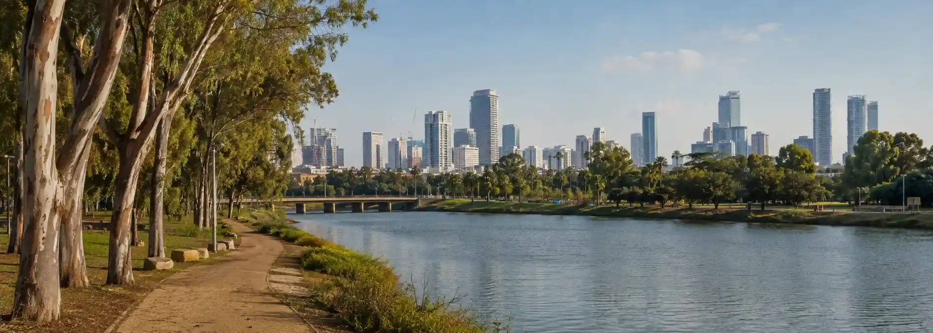
Big cities in central Israel are easier to understand when you stop treating them as separate points on a map. Tel Aviv, Jaffa, the Yarkon corridor, Petah Tikva, and the roads toward Jerusalem form a changing region where dense urban life sits close to water, archaeological ground, parks, and older settlements. A day here can move from a shaded riverside path to a busy boulevard, from a museum about independence to an old port, and from contemporary architecture to a national park shaped by springs and fortifications.
The old idea of a “big cities” route is useful only when it leaves room for these changes of scale. Central Israel is not one continuous city and it is not a single sightseeing checklist. It is a set of connected landscapes. The most rewarding visit gives each landscape its own pace, then uses transport and walking routes to understand how they meet.
Read Central Israel as a connected region
The coastal plain is one of Israel’s most urbanized areas, but the view from a high-rise street can hide the rivers, orchards, wetlands, and archaeological ridges that remain nearby. The Yarkon is one of the clearest ways to recover that wider picture. Its parkland and watercourse create a green interruption in the metropolitan fabric, while Tel Afek and the Yarkon sources show how water, settlement, agriculture, and control of movement have shaped the region over time.
That contrast is the central theme of this route. City life is visible in towers, cafés, cycle paths, museums, buses, and crowded sidewalks. Older layers appear in Jaffa’s port landscape, the remains around Tel Afek, the river’s changing course, and the roads that connect the coast to the interior. You do not need to cover every site to understand the pattern. Choose two or three places that allow the pattern to become visible.
Begin with Tel Aviv’s urban layers
Tel Aviv works best as a walking city when you begin with a clear question. You might follow the relationship between the beach and the inland boulevards, read the White City through its Bauhaus-era buildings, or compare the calm geometry of Rothschild Boulevard with the energy of markets and side streets. The official tourism guide groups the city into distinct areas and experiences, which is a useful reminder that Tel Aviv changes character quickly from one neighborhood to the next.
Do not reduce the city to its skyline. Look at the street edges: balconies, shaded arcades, planted medians, workshop fronts, small religious buildings, and older houses absorbed into new development. These details explain how Tel Aviv grew from a planned modern neighborhood into a metropolitan center. A city walk becomes more interesting when architecture is read alongside ordinary movement rather than isolated as a collection of façades.
The waterfront also changes the rhythm of the day. A promenade can feel open and recreational, while streets a few blocks inland are more commercial, residential, or institutionally focused. Heat, wind, and glare are part of the experience. Begin earlier when possible, build in shade and water breaks, and avoid planning a long walking loop that leaves no time to pause.
Let Jaffa change the scale
Jaffa gives the central Israel route a different sense of time. Its port, lanes, stone buildings, and elevated viewpoints encourage a slower walk, but the area is not a museum frozen outside the modern city. Restaurants, homes, workshops, places of worship, traffic, and visitors share the same streets. The strongest visit respects that mixture instead of searching for a perfectly preserved old quarter.
Move through Jaffa with attention to thresholds. A stairway can connect a dense lane to an open view of the sea. A small courtyard can reveal a building history that is easy to miss from the main route. A modern sign or renovated frontage can sit beside much older masonry. These transitions help explain why a central Israel itinerary needs both urban curiosity and historical restraint.
The Etzel Museum is a useful companion for travelers interested in the political and military history of the coast. Its Tel Aviv waterfront setting and focus on the organization’s role in the events surrounding 1948 add a specific institutional voice to the broader landscape. Read it alongside the streets of Jaffa rather than treating the museum as a complete account. For more context, continue to the Etzel Museum and the story of Israel’s independence.
Follow the Yarkon into the green corridor
The Yarkon introduces a welcome change in pace. Along the park, water, trees, open lawns, bridges, and paths create a landscape that feels separated from the metropolitan rush even though the city remains close. The Visit Tel Aviv guide highlights the park’s opportunities for walking, cycling, boating, gardens, and bird watching. Those activities are not just recreational extras. They show how a river corridor can become part of a city’s daily life.
Give the river enough time to become more than a photograph. Watch the waterline, notice how paths change from paved surfaces to softer ground, and look for the ways bridges and roads interrupt the natural corridor. The park can support a gentle outing, but it is still exposed to sun and can involve more distance than expected. A short section is often more satisfying than an ambitious walk undertaken in the hottest part of the day.
Further inland, the Yarkon National Park connects water, archaeology, and landscape history. The Israel Nature and Parks Authority describes the park as two main areas: the Tel Afek area, also known as Antipatris, and the Yarkon Sources area. They should be planned as separate visits unless current access information confirms otherwise. The connecting gate has been subject to restrictions, so visitors should not assume that a route between the two compounds is open.
Treat Tel Afek as a separate chapter
Tel Afek gives the river story a stronger historical frame. The site includes an ancient fortress with a view over the region, water features, and open ground where the relationship between movement and control becomes easier to imagine. A fortress placed above a water-rich corridor is not only a picturesque object. It suggests why the route mattered to communities, armies, traders, and administrators across different periods.
Walk slowly enough to compare the built remains with the surrounding landscape. The water lilies, pools, vegetation, and open views can make the site feel peaceful, but the peacefulness is part of a long process of management and change. Ask which features are natural, which have been engineered, and which have been preserved for visitors. That question turns a pleasant park visit into a richer reading of central Israel.
The Yarkon Sources area offers a different emphasis, with riverside paths, water, vegetation, picnic space, and traces of older use. It can work well for travelers who want an outdoor break from Tel Aviv, while Tel Afek may appeal more to visitors who want a combination of archaeology and landscape. Check the current official guidance for opening hours, reservations, fees, parking, accessibility, and any temporary restrictions before setting out.
Choose the route that matches your day
A city-focused day can begin in Tel Aviv, continue toward Jaffa, and end near the waterfront. This version suits travelers who want architecture, food, museums, public space, and the changing atmosphere of a coastal metropolis. Keep the route compact enough to allow unplanned stops. The city rewards detours, but only when the main structure of the day remains realistic.
A landscape-focused day can center on the Yarkon park or one of the national park compounds. This is the better choice when you want water, trees, archaeological remains, and a slower rhythm. Bring sun protection, water, and footwear that can handle both paved paths and uneven ground. Do not combine both national park areas on the assumption that they form one open walking circuit.
A history-focused day can connect Jaffa, the Etzel Museum, and a separate museum or heritage stop in Tel Aviv. Visitors returning to Jerusalem can then place the coastal story beside the city’s own historical institutions, including the guide to historical museums in Jerusalem. The point is not to create one definitive national narrative. It is to compare how different places frame the same periods and questions.
Plan the practical details before arrival
Central Israel can look compact on a map while taking considerable time to cross. Traffic, heat, parking, walking distance, and the separation between sites all affect the day. Use current transport information rather than relying on an old timetable, and check whether a national park visit requires advance reservation. Official access pages can change opening arrangements, entry conditions, and route availability.
For the Yarkon sites, confirm which entrance you are using and whether the facilities you want are in that compound. The Nature and Parks Authority notes practical information for both the Tel Afek and Yarkon Sources areas, including access, opening hours, parking, and visitor facilities. A few minutes of checking before departure can prevent a long detour or an arrival after the entrance has closed.
Respect the fact that these are lived and managed landscapes. Keep to marked paths where required, follow staff instructions, carry waste out of natural areas, and avoid entering water or restricted zones. In Jaffa and Tel Aviv, remember that homes, places of worship, businesses, and public spaces share the route with visitors. Good travel behavior is part of reading the city accurately.
Carry the story back toward Jerusalem
Central Israel becomes especially useful in a Jerusalem itinerary because it provides a deliberate change of scale. Jerusalem’s hills, stone, sacred places, and layered neighborhoods feel different from Tel Aviv’s coastal openness and the Yarkon’s low green corridor. The contrast is not a competition between cities. It is a way to understand how geography shapes memory, movement, building, and daily life.
If you are extending a Jerusalem stay, pair this article with the guide to Strauss Street and modern Jerusalem or the Latrun day-trip guide. One keeps the focus on an urban street and its changing communities. The other follows the road and valley between Jerusalem and the coast. Together, they show why a trip through Israel is often best understood through transitions rather than isolated destinations.
Big cities are not only built-up places
The most useful lesson of a central Israel route is that metropolitan life does not erase landscape. Rivers still organize space, parks still create pauses, old ports still shape the imagination of the coast, and archaeological sites still reveal why particular roads and water sources mattered. The city is not separate from these histories. It has grown around them, covered parts of them, restored others, and continues to argue about what should be remembered.
Plan the visit with one clear theme, then allow the route to widen. Start with a boulevard, a museum, a port, or a river path. Notice what changes when the buildings thin out or when the water appears. By the end of the day, central Israel should feel less like a list of big cities and more like a connected landscape where urban energy and older ground remain in constant conversation.
References & Visitor Notes
The Yarkon National Park sections and practical cautions are informed by the Israel Nature and Parks Authority guide to Yarkon National Park and its Tel Afek area guide. The Tel Aviv park context is informed by the Visit Tel Aviv guide to the city’s green spaces. Opening hours, access, fees, parking, reservations, and facilities can change, so check the official pages again before visiting.