
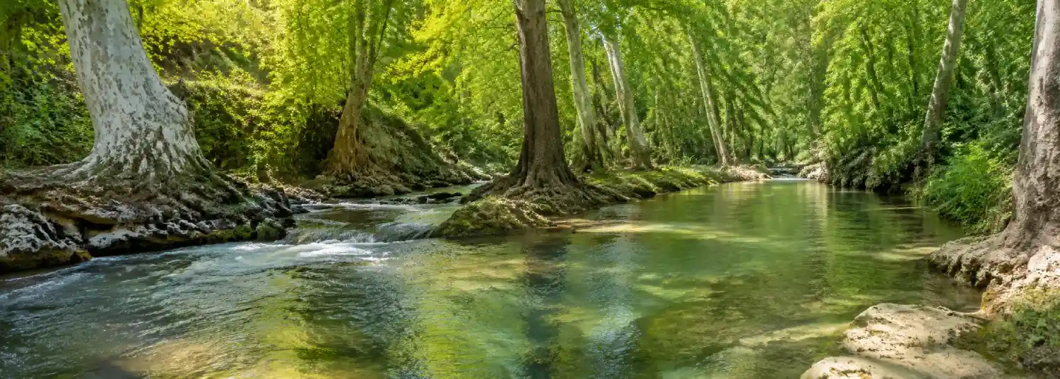
Nahal Snir Nature Reserve is a place where water does most of the introducing. The Snir Stream, also known as the Hatsbani, moves through the Upper Galilee under plane trees and beside pale travertine banks. The reserve is not simply a place to cool off beside a river. It is a compact lesson in how a stream can shape a forest, support wildlife, organize a walk, and carry the history of a wider region.
The reserve belongs naturally within a broader Northern Israel journey, but it asks for a slower pace than a route built around distant viewpoints. The strongest visit begins by noticing the sound and direction of the water. From there, the pools, bird habitat, old pipeline infrastructure, shaded trail, and changing current become connected parts of one landscape. Let the stream set the rhythm before trying to collect every feature.
Meet the Snir Stream
The Snir is the longest of the Jordan River’s tributaries, and the nature reserve protects a section where the river flows throughout the year. The official reserve description places the stream within a well-developed riverside forest of plane trees and travertine walls. That combination gives the visit its character. The canopy softens the light, the water keeps the air moving, and the rock records the slow work of mineral-rich flow over time.
It is useful to think of the reserve as a meeting point between river and route. The water is not a decorative line beside the trail. It determines where the bank can be walked, where shallow rivulets cross the path, and where the landscape opens or tightens. In some stretches, the current feels gentle and transparent. In others, the sound becomes faster and the bank reminds you that a lively stream cannot be treated like a paved park path.
Walk the riverbank with attention
The main riverbank trail follows roughly one kilometre along the eastern side of the stream. Dense plane trees provide shade, while small channels sometimes cross the route before joining the main current. The distance is manageable for many visitors, but the experience is not a race. Stop where the path widens, listen for changes in the water, and look back at the bank to see how roots, stone, and flow share the same limited space.
Water shoes can be useful if you plan to use the permitted wading area, but ordinary walking shoes should still be secure and suitable for uneven ground. Do not assume that every attractive pool or shallow section is available for entering. The reserve protects a living water system, and some parts are closed or restricted for safety and conservation. Stay on marked routes, follow signs and staff instructions, and avoid moving stones or disturbing the riverbed.
Winter deserves special care. The stream can become stronger after rain, and the official visitor information notes that the trail is sometimes closed during winter because of the current. This is one reason to check the Israel Nature and Parks Authority page for Snir Stream Nature Reserve before travelling. A route that feels gentle in one season may demand a very different decision after heavy weather.
Read the pools and the old water infrastructure
Near the entrance, two man-made pools add another layer to the reserve. One is a designated wading pool for visitors. The other provides refuge for rare water plants, including yellow pond-lily and dwarf water clover, which the official reserve guide identifies as plants that have nearly disappeared from the wild in Israel. The distinction matters. A water feature can look inviting without being available for recreation, and responsible visitors should let the habitat remain undisturbed.
The reserve also contains a bird hide beside a reservoir associated with the Trans-Arabian Pipeline, usually called the Tapline. The pipeline is no longer in use, but the reservoir remains part of the site’s water-management story. It was created after damage to the regional pipeline system raised the risk of oil reaching the sources of the Jordan. Today the reservoir stores water and attracts water birds, turning an old piece of infrastructure into a place where engineering, environmental protection, and habitat overlap.
That history changes the way the reserve reads. Nahal Snir is not an untouched scene outside human decisions. Its present form reflects natural flow, conservation work, past infrastructure, and the need to protect a crucial water landscape. Look for the points where the visitor route makes this relationship visible, then give the bird hide time. Quiet observation is more rewarding here than a quick photograph through the trees.
Notice the forest and travertine falls
The plane-tree canopy is one of the reserve’s defining features. Trunks rise from damp banks, branches filter the sun, and the river creates a cooler visual corridor through the surrounding Upper Galilee. The forest is not only scenic. It provides structure for birds, insects, and other life that depends on water and shade. Move slowly enough to notice the difference between the open light at the pools and the darker, more enclosed sections beside the stream.
Along the trail, small falls appear where colder water from the Dan Stream meets the Snir. The falls cut through yellowish travertine, a rock formed by long-term mineral deposition. The stone is a record of older flow as much as a surface for today’s water. Its color and texture can be easy to miss when the river is the obvious attraction, so pause at the bank and look at the layers rather than stepping closer for a better angle.
Farther north, the stream passes through a basalt plateau and forms a deeper ravine. The reserve’s lookout gives visitors a view toward this closed section, while the canyon itself is not accessible to hikers for safety reasons. This is a useful reminder that a nature reserve is shaped by limits as well as invitations. The best route is not always the one that reaches the most dramatic point. Sometimes the lookout is where the landscape can be understood responsibly.
Plan the visit around conditions
Nahal Snir works well as a half-day stop within a larger northern itinerary. The reserve lies on Road 99, east of Kiryat Shmona, with access near Kibbutz HaGoshrim. The official guide advises visitors to follow the signs after leaving the Metsudot junction and to search for Snir Stream Nature Reserve in navigation apps. Allow additional time for the drive, parking, changing weather, and the pauses that make a riverside walk worthwhile.
Check opening hours, reservation requirements, entrance conditions, trail closures, and accessibility information before setting out. The reserve entrance closes before the stated closing time, and seasonal schedules can change. Current guidance matters especially after rain, during periods of high flow, or when local conditions affect access. Carry drinking water, sun protection, a light layer, and footwear that can handle wet or uneven surfaces. Keep food to designated areas and leave the riverbank as you found it.
Respect also means understanding that the reserve is shared by different kinds of visitors. Families may gather near the wading pool, birdwatchers may need quiet beside the reservoir, and walkers may be moving carefully over the trail. Keep noise low near wildlife habitat, do not block narrow paths, and ask before photographing other people. A thoughtful visit protects the atmosphere that makes the reserve distinctive.
Continue the northern water story
Nahal Snir is strongest when it is treated as part of a connected northern landscape. The nearby Jordan tributaries, the Hula Valley, the slopes toward the Golan, and the roads between them explain why water has always mattered here. Pair the reserve with the broader route in A Monumental North, where memorials, viewpoints, and archaeological ground expand the story beyond the river. For a different kind of water landscape closer to Jerusalem, compare it with Sataf’s ancient water routes.
The comparison is revealing. Sataf makes springs, terraces, orchards, and human cultivation visible on the hills outside Jerusalem. Nahal Snir makes flowing water, forest habitat, and regional infrastructure visible in the north. Both places reward visitors who read the landscape as a system rather than a backdrop. Walk the reserve slowly, let the current guide your attention, and the old backlink to Nahal Snir becomes more than a recovered address. It becomes an entry into the living geography of Northern Israel.
References & Visitor Notes
The stream, riverside forest, trail, travertine falls, pools, Tapline reservoir, bird hide, access, seasonal conditions, and visitor facilities are based on the Israel Nature and Parks Authority guide to Snir Stream Nature Reserve. Check the official page again before visiting because reservations, opening hours, trail access, weather conditions, and visitor arrangements may change.