
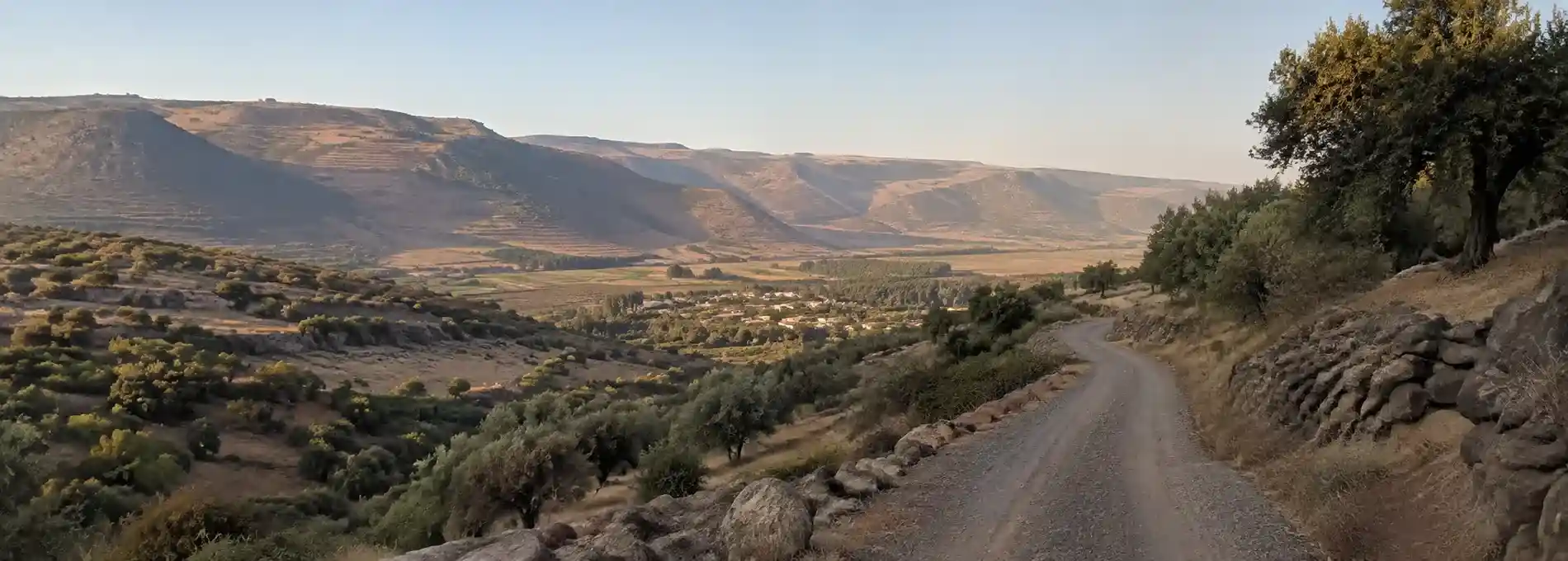
A Monumental North is a journey through the Upper Galilee where memory is carried by roads, ridges, memorials, and archaeological ground. The route moves from the open Hula Valley toward the foothills of the Golan, linking the Helicopter Monument, the lookout landscape around Givat HaEm, and the quieter remains of Tel Anafa. It is not a checklist of attractions. It is a way to understand how a northern landscape can hold military history, rural life, ancient trade, and changing seasons in one wide view.
The distance from Jerusalem makes this a different kind of excursion from the city walks collected elsewhere on JPost Travel. Jerusalem often reveals its history through compressed streets and layers of stone close enough to touch. In the north, the scale opens out. Valleys show why a road matters, hills preserve lines of sight, and a small archaeological mound can sit among fields with the borders and mountains visible beyond it. Give the journey time to change your sense of proportion.
For a closer look at the region’s water landscapes, continue with Nahal Snir Nature Reserve, where a shaded riverbank, travertine formations, and old water infrastructure create a more intimate northern route.
Read the route before you read the monuments
Begin with a map rather than a single destination. The Upper Galilee is a region of agricultural valleys, basalt terrain, forested slopes, streams, and settlements connected by roads that do not always follow the most obvious line on a modern map. Route 918 is especially useful for understanding the journey because it runs through a landscape where water, fields, border history, and access roads meet. Conditions and local arrangements can change, so use current navigation and official visitor information before setting out.
The route is strongest when the drive itself is part of the interpretation. Notice how quickly the view changes after leaving a built-up area. A field becomes a reference point, a ridge becomes a boundary, and an old road begins to suggest why movement through the region required planning. These observations prepare you for the memorial stops. They also prevent the day from becoming a sequence of unrelated pins on a phone.
Pause at the Helicopter Monument
The Helicopter Monument commemorates the soldiers killed when two helicopters collided in northern Israel in 1997. The original JPost Travel account presented the memorial as one reason to visit the north, but the site deserves more than a quick photograph. Its meaning begins with the people remembered there, then expands into the surrounding landscape. The open setting makes the memorial feel connected to the roads and valleys that define movement through the region.
Approach quietly and allow the memorial to set the pace for the rest of the day. Read the names and the available interpretive material. Avoid turning a place of mourning into a backdrop for casual performance, and follow any local rules about access and photography. A respectful visit does not require a long ceremony. It requires attention, restraint, and the willingness to let the site remain more important than the itinerary.
The memorial also offers a useful reminder about the limits of landscape photography. A wide valley can look peaceful while holding difficult histories that are not immediately visible. This tension is part of northern Israel’s character. Beauty and loss are not separate subjects here, and a responsible travel guide should leave room for both.
Take in the view from Givat HaEm
From the memorial area, continue toward the lookout landscape around Givat HaEm. The hill is associated with Henrietta Szold and with the military history of the Galilee Panhandle. From higher ground, the view helps explain the strategic value of the region. The Hula Valley opens below, while the Golan and the mountains beyond create a layered horizon. The exact view changes with haze, weather, and the season, so do not treat the lookout as a fixed postcard.
Spend a few minutes identifying the difference between natural and constructed lines. A field boundary, a grove, a road, and a ridge each organize the landscape differently. When a route has been used for agriculture, settlement, and military movement, those lines overlap. Looking carefully makes the history more legible without pretending that one viewpoint can tell the entire story.
Givat HaEm works best as a pause between the memorial and the archaeological site. It gives the day breathing room and changes the emotional register. After the concentration required at the monument, the broad view returns you to the living landscape. Keep the stop unhurried, but check current access conditions before making a detour, particularly when weather or security arrangements affect local roads.
Make time for Tel Anafa
Tel Anafa brings the route into a much older register. The archaeological site lies in the Upper Galilee near the foot of the Golan Heights, surrounded by agricultural land. Excavations revealed a remarkably well-preserved Hellenistic settlement and evidence of occupation extending from the Early Bronze Age into the early Roman period. The site is valuable precisely because it does not look like a monumental city from a distance. Its low profile encourages visitors to think about settlement, trade, domestic life, and the networks that connected northern communities to the wider eastern Mediterranean.
The remains are easier to appreciate when you resist the urge to imagine a complete city too quickly. Archaeology is built from fragments. A wall line, a piece of pottery, a plaster detail, or the position of a building can raise questions about wealth, taste, commerce, and daily routines. Tel Anafa’s Hellenistic evidence points to a settlement with strong connections to the cultural and economic world of the region. Read the site as evidence rather than as a stage set.
The surrounding fields are part of the experience. They make the relationship between ancient settlement and modern agriculture visible, while the mountains beyond remind you that the site has always existed within a larger geography. If the site is open for walking, wear shoes suited to uneven ground and stay on permitted paths. If access is limited, the landscape still provides context, but do not cross fences or enter restricted areas for a better view.
Before you go
Plan this as a full day rather than a rushed extension to another tour. Northern distances can look modest on a map while taking longer because of winding roads, photo stops, local traffic, and changing access. Start early if you want to include all three themes: memorial, viewpoint, and archaeology. Keep the order flexible, since opening times, weather, and current security guidance may require a change of plan.
Carry water, sun protection, a light layer, and shoes that can handle dirt paths. Much of the value comes from standing outdoors, and shade is not guaranteed at every stop. Spring can bring especially clear color to the valley, while warmer months make an early start more comfortable. Check official information for each site before leaving, and do not rely on an old travel article for current opening hours or road access.
Allow the route to remain thoughtful. The Helicopter Monument asks for attention to loss. Givat HaEm asks you to read terrain and distance. Tel Anafa asks you to accept the fragmentary nature of archaeological knowledge. Together they create a northern journey that is both scenic and historically grounded, with enough space for the land to speak between the formal stops.
If you are building a broader Israel itinerary from Jerusalem, compare this open landscape with a day trip to Latrun, where the Ayalon Valley, military memory, and a monastery create a different kind of historical route. For a city-based contrast, begin with two days in Jerusalem or return to the full Stories collection. Each journey changes the scale, but the guiding idea remains the same: travel becomes richer when the places between the landmarks are given their proper weight.
References & Visitor Notes
The route framing follows the preserved JPost Travel article A monumental north and its historical references to the Helicopter Monument, Route 918, Givat HaEm, and Tel Anafa. Archaeological context for Tel Anafa is cross-checked against the Kelsey Museum of Archaeology at the University of Michigan. Check official local information again before visiting because access, road conditions, and visitor arrangements can change.